8 Metro Phoenix Neighborhoods You Should Know

For a long time, Metropolitan Phoenix felt distant and had been sorely ignored around the middle.

8 Metro Phoenix Neighborhoods To KnowToday that’s not the case. The hottest real estate on the market is smack in the center of town and that emerging historic Phoenix neighborhood you had your eye on is suddenly out of reach. We’ve combed the not-so-mean streets of our city to find eight neighborhoods you might not have heard of and that you definitely need to know more about.

While we’re celebrating these gems, we haven’t forgotten the implications of gentrification and urban development. So we’d like to invite you to be part of the discussion of how Phoenix is developing; what neighborhoods have it right, which are on the wrong path, and what can we do to preserve the past, respect current residents, and create a vibrant future for our city.

Floralcroft
Boundaries: State Avenue, Myrtle Avenue, 59th Avenue, and 61st Avenue, Glendale
Median home price: $140,000
Origin story: Flora Mae Gillett-Statler founded this neighborhood in 1928 and named it after herself. Ten years later, she founded the town of Surprise.
Why it’s emerging: It’s hard to find a bargain in the Phoenix historic housing game, and these homes have the bones and character to rival way more expensive counterparts in Willo, Encanto, and F.Q. Story.

Long before the age of personal branding, hashtags, and celebrity endorsements, Flora Mae Gillett-Statler did something exceptional. She put her name on a west-side neighborhood. In the early 1900s, the daughter of a pioneering clergyman and land speculator made her mark on the Valley by investing in real estate. She founded a town and a neighborhood, naming the latter after herself.

In 1890, Flora was born in Missouri to Rachel and Charles E. Gillett, an old-school multi-hyphenate who brought his family to Glendale, making them among early city residents. Among other things, Charles was a service-station owner, real estate investor, and friend to Arizona’s first governor, George W.P. Hunt.

One of five siblings, Flora married Luther Ward Statler in 1911 and had two children, Vernon and Elizabeth, eventually known as Bette Stofft, a prominent Valley philanthropist and artist.

After World War I, Flora’s father, Charles, opened a service station in Glendale with Homer C. Ludden, with whom he also worked in insurance and real estate. Drawn to speculation, Flora worked at the station and her father’s office. Eventually, she took the reins in Charles’ real estate business, and by the late 1920s, she was ready to branch out and make her own investments. In 1928, she platted an 83-lot neighborhood just north of downtown Glendale and named it Floralcroft.

It’s unclear when she and Statler separated, though public documents note that he spent a lot of time away from home due to business pursuits, including mining. Flora went on to marry her father’s business partner, Ludden, who until 2010 was erroneously credited with founding the town of Surprise. That was actually Flora, who also named the town. (She subdivided land in El Mirage and Yarnell, too.)

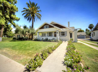
Flora resided in her neighborhood — first in a two-story brick house that served as a model to entice potential buyers and later in a Norman cottage revival that happens to be on the market currently — until her death from breast cancer in 1953.

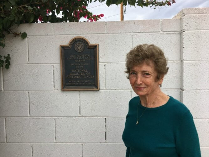
Today, Floralcroft has a spot on the National Register of Historic Places, thanks to its decades-spanning architectural styles, including ranch, bungalow, and late 19th- and 20th-century revivals. Take a drive through the neighborhood, wedged between Caitlin Court and Northfield, and you’ll find sidewalks lined with black street lamps and charming homes in red brick and pink stucco with original crank windows and white wood siding.

Eastlake Park In Central Phoenix
Boundaries: Van Buren Street, Jackson Street, 12th Street, and 16th Street
Median home price: $359,900 (based on one home for sale as of press time)
Origin story: A segregated African-American community arises around Phoenix’s oldest park
Why it’s emerging: Recent renovations, a new community grant, and modern-day cultural significance

If you’re unfamiliar with Eastlake Park, there’s a strong chance you’re not alone — and an even stronger chance you’re, well, white. That’s because, for the majority of its existence, Eastlake Park has served a predominantly African-American community. And while those who have lived, worked, or possibly attended civil rights rallies there may already understand the area’s significance, for everyone else who’s unsure as to what Eastlake Park means or even where it’s located (hint: there’s no actual lake at this point), we need to look back at the neighborhood’s history.

Eastlake Park, formerly Phoenix Park, was established in 1890 by Moses Sherman and later purchased by the city of Phoenix in 1914. During its early-20th-century development, Eastlake Park and the surrounding neighborhood of the same name, along with areas in west and south Phoenix, became home to Phoenix’s black community.

This had less to do with choice and more to do with a lack of opportunity for African-Americans. Between limited funds, increasing segregation, and later an all-out combined effort from banks, real-estate agents, and lending agencies to prevent African-Americans from moving north of Van Buren Street, it was difficult for black residents to live elsewhere.

As a result, Eastlake Park was comprised almost entirely of black-owned businesses, churches, and schools such as Tanner Chapel A.M.E. Church and the Booker T. Washington School (now occupied by Phoenix New Times). It also bore witness to many of the historic milestones made by African-Americans in Arizona during the 20th century, including speeches by Booker T. Washington in 1911 and Martin Luther King Jr. in 1965, the founding of Arizona’s first African American-owned newspaper, the Phoenix Tribune, and the founding of the Booker T. Washington Hospital in 1927 by Phoenix’s first African-American physician, Dr. Winston Hackett.

As the Civil Rights movement gained momentum in Phoenix during the 1940s, Eastlake Park became a hotbed for protests against inequality and discrimination. But progress was slow, and by the 1960s, Eastlake Park had begun to change. Housing started to deteriorate, residents who could relocate did, and business development waned, leaving the area in a less than ideal state.

In 2013, Eastlake Park underwent a $4 million renovation to upgrade its facilities. This past spring, Eastlake was one of nine communities selected to participate in the inaugural AZ Creative Communities Institute, a collaborative program for improving communities through creative efforts.

“Eastlake is one of the few truly diversified urban neighborhoods being redeveloped with a history of leadership and community involvement.” says Virgil “Jackie” Berry, one of the team members chosen to represent Eastlake Park in the AZ CCI grant.

The Eastlake AZ CCI team notes that while the neighborhood is experiencing positive change in recent years, it’s been at an inconsistent pace. Still, they’re working to explore ways they can create a better environment for the Eastlake community while at the same time memorializing the area’s past, because at the end of the day they all agree, “Eastlake is the soul of the city of Phoenix.”

Squaw Peak Groves In Central Phoenix
Boundaries: 12th Street, 12th Place, Glenn Drive, and the Arizona Canal
Median home price: $423,900
Origin story: Former citrus groves turned midcentury suburb
Why it’s emerging: Trendy new restaurants, a prime central location, and atomic ranch appeal

If you’re looking for the sweet spot south of Sunnyslope but north of uptown, we’ve got three words for you: Squaw Peak Groves. Tucked between 12th Street and 12th Place, Glenn Drive and the Arizona Canal, this hidden gem of atomic ranch homes built primarily between 1960 and 1962 — is a suburban dream.

Set against the backdrop of Piestewa Peak, this cluster of cul-de-sacs and winding no-outlet drives delivers on generous lots, manicured lawns, and quaint facades that feel familiar to anyone who grew up in Phoenix’s more mid-century developments: breeze-blocks, weeping mortar, and yes, maybe even a pastel paint job here and there. It’s ideal for anyone looking to raise a family without relinquishing that coveted central location.

While there aren’t as many, or any groves as the name would lead you to believe, Luci’s owners Ken and Lucia Schnitzer have been bringing the area’s past front and center with their multi-use space, The Orchard.

Located on a former citrus farm and nursery, presumably the source of the development’s original name, The Orchard features Luci’s second location, Splurge Ice Cream and Candy Shop, and Pomelo, an Italian eatery with a citrus name to pay homage to the neighborhood’s history.

Since its opening in 2016, the generous space has become a hotspot for 12th Street corridor in North Central residents looking for a place to gather with their kids, dogs, and the influx of new neighbors. Actually, The Orchard has become a major selling point for the once-sleepy neighborhood, where Ken Schnitzer says that home values have definitely increased. And he’s not surprised.

“Across the United States, people would build housing developments and then shopping centers would go in there and they’d say okay, there’s a need for shopping centers and open a store and restaurants and they’d come in after. Nowadays, the restaurants and places are there and people want to live in the area. So it’s backwards now. You don’t want to move to central Phoenix if there’s no cool places. But if there’s Luci’s and Stock & Stable and The Yard and Windsor … you want to be there.”

And to Schnitzer’s point, there’s very little for sale in Squaw Peak Groves at the moment. Those that are available are a mix of mint condition grandma-chic and newly flipped homes from investors who knew a good deal when they saw one. Either way, interested buyers are encouraged to keep their eyes peeled because a home in the Groves gets snatched up quickly. 

West Side-Clark Addition
Boundaries: Country Club Drive, Date Street, Second Place, and Pepper Place, Mesa
Median home price: $190,000
Origin story: This was Mesa’s first suburban neighborhood.
Why it’s emerging: Although it’s a suburb, West Side-Clark looks nothing like your average Mesa stucco-and-tile fest. After years in limbo, it was finally granted historic status in 2017.

Mesa doesn’t have a reputation for architecture — let alone historic architecture. But a cluster of bungalows and ranches situated just west of the city’s original townsite bucks that stereotype.

With homes built between 1930 and 1958, the neighborhood, known as the West Side-Clark Addition, stands out as Mesa’s first move from an agricultural settlement to the sprawling, third-largest city in Arizona that we recognize today.

“This is the seventh historic district for the city of Mesa, but it could’ve been one of the earlier ones,” says Lauren B. Allsopp, who worked with the city’s Historic Preservation Office to secure the neighborhood’s recognition as an official Mesa Historic District. The former farmland already had landed a spot on the National Register of Historic Places.

Allsopp says West Side-Clark is notable for a couple of reasons. First, it’s a prime example of bungalow and ranch housing that gave Mesa its original architectural style. And second, its residents were passionate about having the neighborhood preserved — even though it took a while to make that happen.

As Allsopp explains it, the process for historical designation began in 2004. But it was shelved when the recession hit and the city temporarily didn’t fill the full-time role of Historic Preservation Officer. (Another city employee served as the acting officer, but had several other responsibilities.) When Allsopp joined the office in 2016 on contract, she was able to help reinvigorate the project.

“It’s not the all-one-color tile roofs that you see today,” Allsopp says. “In the 17 years that passed — believe it or not — the neighborhood hardly changed at all.”

That’s a significant factor in a historic designation. In addition to houses still retaining notable features and materials, there were a few more structures that had aged into historic eligibility — or were resorted appropriately.

“Originally, over on Date, there was a little enclave of row houses that weren’t included, and now they were old enough,” she says. Another home became eligible for inclusion after its owners removed siding that covered original materials used in construction.

Residents worked closely with Allsopp to circulate a petition (which is required by Mesa) to move forward with the historic process. It paid off — and the neighborhood got the preservation nod.

This is the first of what Allsopp hopes will be several preservation success stories for Mesa. She’s working on other projects with the city currently, including a recent analysis of the Nile Theater’s mortar, preservation of the city’s neon signage, and securing grants for other neighborhoods.

Still, she says, West Side-Clark was special because she knows how much work went into it.

“I can show you a bungalow, I can show you a Tudor, and I can show you how people have made it work in the 21st century without ruining the character,” Allsopp says. “This is a neighborhood where you’ll want to walk.” B.B.

Garfield Historic District
Boundaries: Seventh Street, 16th Street, Van Buren Street, and Roosevelt Street
Median home price: $269,000
Origin story: Former farmland turned booming middle-class residential development in the early 20th century.
Why it’s emerging: An influx of hot new restaurants and boutiques, a downtown Phoenix resurgence, and still somewhat affordable historic housing.

Tell native Phoenicians — your parents, for example — that you’re looking at houses in the Garfield district, and they might do a double take. That’s because up until very recently — say, the last five years — the historic downtown Phoenix hood had seen better days. Early 20th-century homes had fallen into either poorly stuccoed despair or complete disrepair. Historic storefronts sat abandoned. And despite the heavy foot traffic of the revitalized Roosevelt Row arts district just a block away, Garfield remained more or less a ghost town for downtown visitors.

That wasn’t always the case. In its heyday, Garfield was a thriving residential development bound by what is now Seventh and 16th streets and Van Buren and Roosevelt streets. Between the 1910s and 1920s, approximately 500 houses were built to meet the demands Phoenix’s early population boom — a growth spurt attributed to the 1911 completion of the Roosevelt Dam. By 1935, 85 percent of the former farmland had been converted into housing, offering up a selection of bungalow, Craftsman, Spanish Colonial Revival, Tudor, and English Cottage-style homes to primarily middle- and working-class families.

Not only did the neighborhood give residents direct access to the then-essential Phoenix Street Railway, it also offered an assortment of conveniently located commercial spaces: churches, groceries, even a pharmacy. That same pharmacy, now an indoor plant nursery called Pueblo, is just one of the spaces that has seen new life in recent years, thanks in part to downtown’s resurgence as a whole.

“I just wanted to be as close as possible to my own house,” says Michael Lanier, Garfield resident and Pueblo owner. “I wasn’t trying to focus on opportunity. I was just trying to improve the area where I live for the residents and myself.”

Lanier isn’t alone. At the same intersection of 10th and Pierce streets, businesses including Gallo Blanco and Welcome Diner are also laying down roots, bringing with them an influx of hipsters, foodies, and home buyers who aren’t afraid to get their hands dirty. Throughout the neighborhood, construction is in full swing, and homes that were once selling well under $200,000 just last year are now going for roughly double the price.

Despite its seemingly overnight popularity, however, Lanier is reluctant to label Garfield as the next big thing. “There’s a really fine line with that, to call it emerging. But it really is on sort of a come-up. I think a lot of the residents that have been here five, 10, 15, 20 years have always appreciated it and have wanted it to be better in the sense that anything could be better.”

Like any homeowner who wants to have his cake and eat it, too, Lanier just hopes that Garfield’s newfound attention doesn’t take away from the initial charm and affordability that initially drew him and others to it. “It’s improving greatly. And hopefully that starts working out for the both longtime residents and new [ones],” he says. K.J.

Brentwood Historic District
Boundaries: 16th Street, 20th Street, Brill Street, and Culver Street
Median home price: $199,000
Origin story: Former farmland turned early-20th century residential development
Why it’s emerging: Affordable historic housing, a central Phoenix location, and a influx of new restaurants and shops along the neighboring Miracle Mile.

If you’ve ever driven by the modest remnants of Phoenix’s once-thriving Miracle Mile — a generous strip of storefronts along McDowell Road that served as a prominent shopping destination in the 1950s — chances are you’ve passed its even less-assuming historic neighborhood, Brentwood. Nestled between 16th and 20th streets and Brill and Culver streets, this freeway-adjacent residential area has remained, for the most part, undisturbed, thanks to its limited-access streets.

With its collection of 19th- and 20th-century revivals, including Tudor, Southwest, Spanish Colonial, and bungalows, Brentwood offers a vibe not too dissimilar from more established historic neighborhoods, but without the gentrified price tag.

Like other neighboring districts, Brentwood homes began as farmland, but thanks to Phoenix’s transportation growth and a population that doubled roughly every decade between 1900 and 1940 (it quadrupled in the 1950s) the area was platted for residential development beginning in 1924. By the time of its completion in 1956, Brentwood was composed of six subdivisions — McDowell Heights, Brentwood, Brentwood East, Wright Davis, Valley of the Sun, and Governor Hunt Tract. However, a good portion of the neighborhood later had to be razed to make way for the construction of State Route 51 and Interstate 10.

Still, despite some patchy areas, the neighborhood maintains its historic charm and a central location thanks to its proximity to the concentration of topnotch Mexican dining along 16th Street and of course the Miracle Mile, which, according to residents and business owners, is poised for a comeback. Actually, some of Phoenix’s more popular restaurants and retailers have set up shop along the McDowell corridor over the last few years, including Tacos Chiwas, Ollie Vaughn’s, and Rubymint General Store. Artists like Emily Costello and Kathy Cano-Murillo have arrived, too.

When asked if the area is gearing up for a resurgence, Rubymint General co-owner Kui Mi Oh is hopeful. “[It] used to be the main drag back in the day, so it would be nice to revitalize that. There’s a lot of businesses that have been trying to move on the Miracle Mile, so revamping it would definitely be a plus for us, and I think for the neighborhood as well.”

Aislyn Richmond, McDowell Corridor Coordinator, is working to make it happen. Through a partnership among the Phoenix Community Alliance, Banner Hospital, and Trellia, a nonprofit specializing in affordable housing and community development, Richmond is able to host cleanup events, workshops with businesses in the area to help them succeed, and visioning sessions with residents in Garfield, Coronado, and Brentwood to make sure ideas are being heard.

“The main goal is that [the Miracle Mile] is a very locally focused. So it’s supposed to really serve the neighborhoods here and be community-driven with services that the neighbors can really appreciate while still maintaining the history of the area and bolstering that.”

Garden Apartment District
Boundaries: 68th Street, Fifth Street, Goldwater Boulevard, and First Street, Scottsdale
Median home price: $180,000
Origin story: South of the Hotel Valley Ho, more than 15 upscale garden apartment complexes were built in the mid-20th century. Originally marketed to seasonal tourists, this is a unique collection of multifamily housing that ranges from luxury to kitschy and dramatic.
Why it’s emerging: As housing prices creep up, apartments and condos are once again prime real estate investments. And this particular cluster of apartment buildings has been recommended for historic designation.

Back in the 1950s, Scottsdale was a Hollywood playground. Swanky hotels, new businesses, and tourist attractions set the stage for a multifamily housing boom. One hundred such complexes were built between 1948 and 1964 to accommodate people who wanted to live in the suburb.

The influx came, in part, because of high-level job prospects at Motorola, which announced plans to open a facility in the suburb in the late ’50s.

Nearly 20 garden apartment complexes popped up just south of Hotel Valley Ho, a resort that opened for business in 1956, designed by Frank Lloyd Wright student Edward L. Varney.

Motorola used the hotel to house employees while they looked for permanent residences in the area. And the Valley Ho welcomed entertainers including professional baseball players and the cast and crew of Alfred Hitchcock’s Psycho. Perhaps most notably, Natalie Wood and Robert Wagner hosted the reception for their first wedding in 1957 at the Valley Ho.

It was an exciting time for the suburb, says Ben Brosseau, a Realtor and Garden Apartment District resident. That history and Old Hollywood glamour is what drew the midcentury modern enthusiast and film buff back to Scottsdale after living in Los Angeles for about a decade.

It’s also why he’s working to get the neighborhood a historic designation — something that’s been on hold for a few years.

Brosseau lives at the Shalimar Sands complex, which, alongside buildings like Embassy and Capri, mirrored the designs of destination hotels like the Valley Ho, and the neighboring Safari, which was designed by Al Beadle and later demolished.

“People didn’t just buzz out here for a couple days,” Brosseau says. “They came for a week.”

Those two hotels drew visitors, and demand for Scottsdale rentals skyrocketed. Around the same time, multifamily housing construction was supported by government incentives. Hence, the boom.

Turns out, some of Scottsdale’s garden apartments are architecturally significant for several reasons, according to Steve Venker, Scottsdale’s Historic Preservation Officer. Venker says the district near Valley Ho has one of the best collections of upscale garden apartments in metro Phoenix, and it’s important because of “its use of theme designs and dramatic facades as part of ongoing marketing efforts to attract the seasonal resident.” Also of note is the “range of modern styles, varied use of materials, decorative features, and extra amenities.”

Though a study recommended several of the Garden Apartment District buildings as eligible for historic status, the project was shelved a few years back.

But Brosseau’s taking action. “The city can only get so involved with projects like this,” he says. “They have to wait for people to rally a neighborhood.”

That’s why he’s working to get all the buildings’ homeowners associations on the same page, and he hopes to make major progress next year. Then, they can take more formal steps toward preservation.

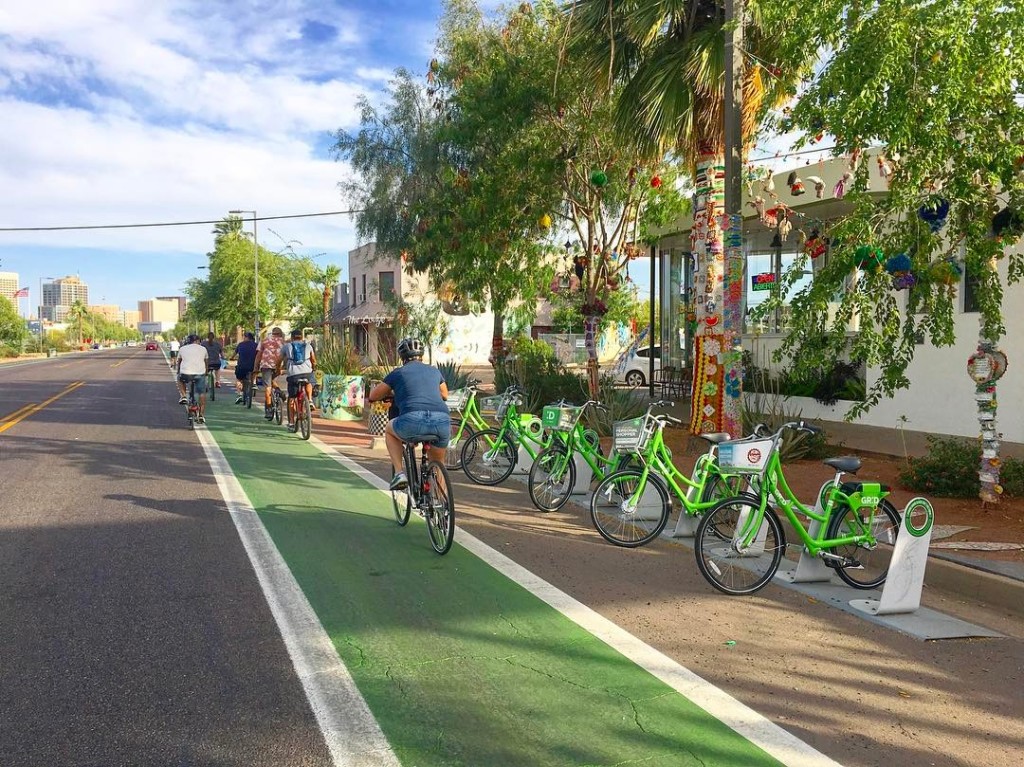
Regardless, the neighborhood’s time capsule-like midcentury dwellings are just a hop away from Scottsdale’s arts and entertainment districts. Make that a bike ride, as the city’s recently implemented a bike-share. Brosseau asks, “How great is that?!” B.B.

Warehouse District In Phoenix
Boundaries: Jefferson Street, Sherman Street, Seventh Avenue, and Seventh Street
Origin story: An industrial district and former home of Phoenix’s Chinatown with railroad proximity.
Why it’s emerging: A flood of new businesses, warehouse renovations, and a downtown resurgence.

In major metropolitan cities across the country, warehouses have long been en vogue, operating as clubs, co-ops, studio apartments, and of course industrial chic wedding venues. But like many things our cosmopolitan cohorts have created, Phoenix has admittedly been a little late to the game.

Despite the fact the fifth-largest city does in fact have a bona fide warehouse district — its debated boundaries fall between Seventh Avenue and Seventh Street, Jefferson and Sherman — for decades, urban dwellers and developers were reluctant to recognize the area south of downtown as anything more than storage space and potential parking lots.

Fortunately for these early 20th-century buildings — which have housed everything from wholesale grocers to Phoenix’s now-lost Chinatown — preservationists like Brian Cassidy of CCBG Architects have sought to turn things around. Since constructing their own offices at the corner First and Buchanan streets 12 years ago, the architectural team specializing in, among other things, adaptive reuse, have witnessed firsthand how the warehouse district is making an 11th-hour comeback.

So far, roughly two-thirds of the warehouse renovations have been handled by CCBG architects, including spaces like R & R Partners, The Croft, Grant Street Studios, IASIS Healthcare, Moses Inc, and most recently, the 411 Building, soon to be the home of Scottsdale-based software company Scientific Technologies Corporation.

Cassidy, who’s also Warehouse District chair, says CCBG averages two inquiries a month from businesses looking to move into the warehouse district. But at this point, demand outweighs supply. “Nothing is immediately available. All the space that could be available is going to take anywhere from three months to a year to renovate the buildings.”

So why the sudden rush of ready-to-relocate businesses in the Warehouse District? Cassidy has a few ideas. “We’re seeing that a lot of creative type businesses … their employees are more interested in unique buildings and buildings that you can literally walk out the front door and be out on the street — be close to the restaurants, the entertainment, the bars, and so forth.

Cassidy also credits the warehouse district’s upswing to the catalysts of downtown’s own renaissance: ASU’s downtown campus, the expansion of the Phoenix Convention Center, and Valley Metro’s ongoing light rail expansion, which is set to extend directly through the warehouse district to Baseline Road.

“I always felt that people living in Phoenix wanted a better urban experience but it wasn’t being offered,” he adds.

Now, however, downtown and its subsequent Warehouse District are finally getting the recognition they deserve, thanks to new bars, new restaurants, a grocery store coming in 2018, and a plethora of high-rise residences, including the warehouse district’s first residential development in a decade, set to break ground next year.

“This area’s really going through a resurgence,” Cassidy says. “And if you could fast forward five more years, you’d really be amazed at what’s likely going to happen down here.”
To buy or sell any historic Phoenix home in the Central Phoenix or Downtown area, call Laura Boyajian for her expertise in historic homes real estate.

A History of a Historic Preservation Advocate

G.G. George, the Phoenix author of the new book, “The Arizona State Fair,” has a history of preservation activism dating back to the 1960s and remains an active voice in the historic community today for Historic Phoenix Districts.

Historic Phoenix Preservation“G.G. George is the Energizer Bunny of historic preservation,” said Kathryn Leonard, the Arizona State Historic Preservation Officer.

Most recent, the Norton House and all of Encanto Park were listed on the National Register of Historic Places. This completed a project led by George, the president and founder of the Encanto Citizens Association, and the president of the Phoenix Historic Neighborhoods Coalition, to put the entire Encanto Neighborhood on the National Register, which was started in the 1970’s.

And these are only a few of her accomplishments.

“G.G. has always been an extremely valuable voice in the historic preservation movement in Phoenix and it dates back to when all of our historic districts downtown were considered blighted, and nobody wanted to live in them,” said Leonard.

Papago Freeway

George began her work back in 1969 when she heard the plan to construct the I-10 Papago Freeway was displacing residents from their homes. These homes were in the area known as the Moreland Corridor, located between McDowell and Roosevelt Streets and Central and 19th Avenue.

At the time, the Arizona Highway Department, now known as the Arizona Department of Transportation, was offering homeowners less than what their houses were worth so that they could begin construction on the freeway, according to George.

“The freeway fight spurred preservation awareness,” said George. “The homes they were tearing down in the Moreland Corridor were just as nice as this house, just as old and even older,” said George, referring to her home in the Encanto-Palmcroft neighborhood.

George was invited to a meeting by a group known as Citizens for Mass Transit Against Freeways which included a group of concerned neighbors who wanted to make a difference. George attended the meetings, heard the stories from the people who lost their homes, and wanted to help in some way.

“She really was instrumental in saying ‘Hey, these houses have value,’” said Leonard.

According to George, the people in this neighborhood had no idea there was anything they could do to stop the construction of the freeway until a few activists organized the neighborhood. Nearly 2,000 neighbors came together to express their dissent against the construction.

In 1973, a vote appeared on the ballot which determined the fate of the freeway. The Citizens for Mass Transit Against Freeways and preservation advocates won their first battle when construction of the freeway was voted down.

The Department of Transportation had to scrap their original plan for the Papago Freeway, which led to the development of a new plan of an I-10 tunnel under Margaret T. Hance Park.

Arizona State Fairgrounds

Over the years, George has worked on countless other efforts to preserve historic buildings. Most recent, when the Works Progress Administration (WPA) building, located on the Arizona State Fairgrounds near Fairview Place Historic District, was threatened with demolition, George supported the effort to save it.

George wrote “The Arizona State Fair,” a book that chronicles the history of the fairgrounds from its formation in 1905 through the Great Depression when the WPA building was built. George wrote the book “to stimulate interest in the preservation of the buildings and the grounds.” According to George, the profit from the books goes toward historic preservation efforts.

“I devote all my time, research, and writing ability to the [Encanto] citizens association who gets the profits from these books to carry on our work,” said George.

According to Jim McPherson, president of the board of directors for the Arizona Preservation Foundation, George was very supportive of this effort from both a preservation and neighborhood standpoint.

“We have been really appreciative of G.G. in undertaking that major project,” said McPherson regarding George’s book.

Moving forward, George said that she will continue to fight to preserve the integrity of historic districts.

“If we don’t understand the past we can’t even plan for the future,” said George.

Bill Gates Buys 25,000 Acres of Land in Phoenix Area

Bill Gates buys 25,000 acres of land to build the ‘smart city of the future’ in Arizona designed around self-driving cars and high-speed data networks

  • The city, known as Belmont, will be designed around ‘cutting-edge technology’
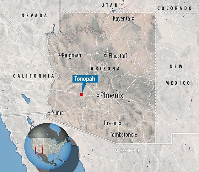
  • It will be built in a remote area in Tonopah, around 50 miles west of Phoenix
  • Plans call for 80,000 homes and 3,800 acres of industrial, office and retail space
  • The site will include 3,400 acres of open space and 470 acres for public schools

Bill Gates Buys 25,000 Acres of Arizona LandBill Gates has bought $80 million worth of arid desert in Tonopah, Arizona, just outside of Downtown Phoenix, to build a new ‘smart city’.

The planned community, known as Belmont, will be designed around cutting-edge technology, including self-driving cars and high-speed data networks.

The city will be built on a 25,000-acre plot in a remote area in Tonopah, around 50 miles (80 km) west of Phoenix.

While few people currently live in the area, the plans call for as many as 80,000 homes and 3,800 acres of industrial, office and retail space.

The site will include 3,400 acres of open space and 470 acres for public schools, according to Arizona-based Belmont Partners, the real estate developer behind the project.

The firm, which forms part of a group controlled by Cascade Investment LLC, an investment firm run by Gates – said the goal is to turn the area into a ‘smart city’.

‘Belmont will create a forward-thinking community with a communication and infrastructure spine that embraces cutting-edge technology, designed around high-speed digital networks, data centers, new manufacturing technologies and distribution models, autonomous vehicles and autonomous logistics hubs,’ the company said in a press release.

If you’re interested in buying a home in or near any Phoenix neighborhood or even specifically in Tonopah, you should contact Laura Boyajian, Licensed Real Estate Agent at 602.400.0008.

Phoenix Real Estate with Historic Roots Now For Sale

Uptown Phoenix Parcel with Historic Roots Now For Sale

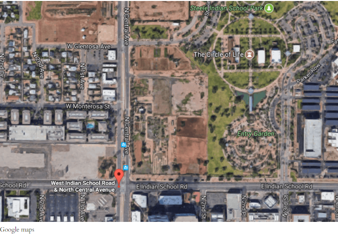
A piece of Phoenix real estate with historic roots is now for sale. As part of the recent settlement of litigation between the United States and the Barron Collier Company, the federally-owned 15-acre parcel located at the northeast corner of Central Avenue and Indian School Road is now for sale. The land, which is located amid the booming Uptown Phoenix real estate market, is being marketed as the “Uptown Phoenix Parcel.”

The parcel was recently transferred by Barron Collier Companies to the United States for sale under an agreement that resolved Collier’s legal obligations to the United States dating back to the Congressionally approved 1988 Arizona-Florida Land Exchange Act, a deal that originally included the historic 72-acre Historic Phoenix Indian School site that had been operated as a school for Arizona Indian students for almost 100 years until its official closure by the Bureau of Indian Affairs in 1990.

Historic Uptown Land For Sale in PhoenixThe 15-acre Uptown Phoenix Parcel is located across from a light rail station, just one block south of the Camelback Road and Central Avenue.

It was recently named by the Urban Land Institute of Arizona as one of the Valley’s most lucrative intersections for commercial and residential development.

Proceeds from the sale of this Historic Phoenix parcel will be deposited into the Inter Tribal Trust Fund and Navajo Trust Fund administered by the United States for use by tribes in Arizona to seed educational programs and services such as tribal libraries, preschools, childcare facilities, youth foster homes, tutoring and academic counseling for tribal youth, among other programs.

Most of these programs have been placed on hold in recent years due to limited funding and uncertainty surrounding the future of these Trust Funds.

Many of Arizona’s current tribal leaders attended the Phoenix Indian School in their youth. When it closed, Congress made sure that the funds generated from the disposition of the property could be used to support a positive and enduring legacy for both the former Indian School, and the future of Indian education in Arizona.

While the history of the Phoenix Indian School has been written, tribal leaders also look forward to supporting a new legacy that the sale of this long vacant property now represents.

“We are very pleased to see the that remaining 15-acre property, which is so steeped in the history of tribes in Arizona, will finally have an opportunity to be developed and hopefully become another Phoenix cultural highlight in the future of Uptown Phoenix,” says Inter Tribal Council of Arizona Executive Director, Maria Dadgar.

“Not only will the sale of this property begin a new chapter for the City of Phoenix, the funds generated from the sale will also serve the future of Indian education in Arizona as Congress originally intended. Tribal leaders view this as a positive step in the history of the Indian School property,” says Dadgar.

The federally-owned Uptown Phoenix Parcel will be sold by a competitive online auction hosted by the Government Services Administration’s online site www.RealEstateSales.gov and will open for bids later this year.

The Inter Tribal Council of Arizona, Inc., was first established in 1952 to provide a united voice for tribal governments located in the State of Arizona on common issues and concerns. Currently, ITCA’s membership includes 21 of the 22 Tribes of Arizona.

Historic Roosevelt Home 2017 Tour Explores Phoenix’s Rich History

The annual Historic Roosevelt Neighborhood Home Tour will be taking place Sunday, November 19 from 10 am to 3 pm. Presented by the Roosevelt Action Association.

This tour will feature many historic properties in Phoenix’s “first suburb.”

2017 Historic Roosevelt Home Tour

A perfect example of an early twentieth century home in Roosevelt Historic District

The historic Roosevelt home tour will take you through neighborhoods built in the late 19th century to the 1930s, from McDowell to Van Buren, and Central to 7th Avenue.

This tour will explore the history of the featured homes as well as the turn of the century architecture, including bungalows, Neoclassical, Tudor, Period Revival and Southwest Vernacular homes.

The Roosevelt Neighborhood was the first neighborhood in Phoenix to receive historic designation, one of 36 historic neighborhoods in Phoenix. It is considered the city’s first suburb, and was the home to several prominent early Phoenicians.

Learn about the residents, the historic architecture, and so much more as you walk down the 100-year old streets alongside towering, century-old palm trees and explore the rich history of Phoenix.

The Roosevelt Action Association holds this informative historic home tour every year to promote the understanding of Phoenix’s past, and to foster neighborhood pride. There will also be food trucks and a craft fair, making this a perfect family event.

The self-guided tour tickets are $13 through Nov. 18 and $16 day of event. Guests can buy tickets to tour guided by “hip historian” Marshall Shore for $22 through Nov. 18 and $25 day of event.

If you go:

What: The Historic Home Tour
When: Sunday, November 19, 10 a.m. to 3 p.m.
Where:  Between McDowell and Van Buren, from 7th to Central Avenues.
Tickets: Buy online through Nov. 18 or at the event on Nov. 19. Visit rooseveltneighborhood.org

The Historic Roosevelt Neighborhood is a modern name for a series of historic neighborhoods that grew North of the city between 1893 and 1930 and it spans from McDowell to Van Buren and from Central Ave to 7th Avenue.

Every year, The Roosevelt Action Association hosts a family friendly and informative historical home tour where you can explore turn-of-the-century architecture (Bungalows, Neoclassical, Tudor, Period Revival and Southwest Vernacular Homes).

Train Depot Home Up For Sale In Phoenix

There are a lot of very cool homes in the Valley, but some stick out more than others.

Train Depot in Historic Phoenix

Train depot home up for sale in Phoenix

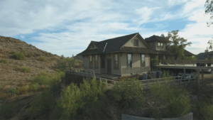
In North Central Phoenix sits a home on top of a hill that has a unique history. It used to be a train depot in Mayer, a town more than 70 miles north of Phoenix.

The history is very cool. The train depot began operation in Mayer in 1898. It was in full operation until it finally shuttered in the 1950s. For years it sat decaying to the ravages of time, but a Phoenix man named Don Dedera had a great idea: ship the depot to the Valley and turn it into a home.

So, in early 1963, the train depot was placed on a moving truck and shipped south.

It wasn’t an easy task. It was brought down the Old Black Canyon Highway and telephone and power lines had to be moved out of the way. At one point, the moving truck turned toward the Deer Valley Airport and was able to drive down the runway to avoid even more telephone lines. Eventually, it ended up on a hill and became part of a new home.

Fast forward to a few years ago, the most recent owner, Will Auther and his wife spent nearly a year fixing up the home, and they lived in it for nearly 13 years.

Now, they’ve decided to put it on the market. They hope that someone will take it over and keep the history of the home alive and help to keep the story of the traveling train depot alive.

Metro Phoenix’s Hottest Intersections to Live, Work and Play

Metro Phoenix’s Hottest Intersections to Live, Work and Play

Uptown Phoenix was a hot spot for restaurants, shops and clubs in the 1970s and 80s.

Then the cachet fizzled a bit as the Valley’s suburbs boomed.

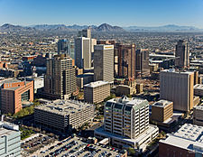
But Camelback Road and Central Avenue, the heart of Phoenix’s uptown area, as well as Phoenix’s Midtown area, are back as a thriving hub for popular restaurants, cool boutiques, office space, light rail and historic neighborhoods and their homes.

Downtown Phoenix, AZ Historic District

Central Avenue Corridor

It’s now the Valley’s most popular intersection, according to a new poll among real-estate and growth experts.

Urban Land Institute Arizona members recently voted the central Phoenix spot the “hottest intersection” in metro Phoenix. It beat out Phoenix’s Camelback and 24th Street, an area that garnered the title the last time the group voted a decade ago.

“Camelback and Central has old buildings with great design, diversity and very supportive neighbors,” said Craig DeMarco, restaurateur and a founder of Upward Projects, at the Urban Land contest last week. “It’s the only intersection in the entire Valley with four historic neighborhoods surrounding it.”

Camelback and Central didn’t even make Urban Land’s top 10 list for hottest intersections in 2007.

A lot has changed since then. A boom and bust, light rail and a move toward an urban lifestyle by more Valley residents have shifted our growth.

Plus, DeMarco’s group has opened five restaurants, including a Postino, Windsor and Federal Pizza, around Camelback and Central over the past decade.

Other rankings on Urban Land’s top 10 list:

  • Downtown Tempe’s Mill Avenue and Rio Salado Parkway was voted No. 2 in the hot-intersection contest. The popular urban hub moved from third a decade ago. Matt Mooney, managing director of Cousins Properties, pointed out that Tempe led the nation for filling existing office space with tech firms from 2014-16.
  • Scottsdale and Camelback roads came in at No. 3, after hitting No. 2 the last time. Real-estate attorney Jordan Rose, who has an office at this Scottsdale intersection, said people can shop, eat, work, vacation, get their hair done and even buy a Tesla at Camelback and Scottsdale.
  • Chandler’s bustling Arizona Avenue and Chandler Boulevard tied for fourth. Danny Plapp of LGE Design Build pitched the area for its $70,000 median household income, office space, new apartments and jobs. “A younger, richer and hipper generation wants to live in new suburbs like Chandler,” he told the crowd. “Just look at San Tan Brewery’s sales at this intersection.”
  • Phoenix’s 24th Street and Camelback intersection and the Camelback Corridor tied for fourth. The area is still a hot spot of offices, hotels, shopping and eateries but has a lot more competition now.
  • At No. 5 is the Scottsdale Road and Greenway Hayden Loop area, near the city’s popular airport. Danielle Casey, Scottsdale economic-development director, said there are often “celebrity sightings” at the airport and in the area. The intersection didn’t make the list the last time.
  • Downtown Phoenix’s Central Avenue and Roosevelt near Roosevelt Historic District ranked No. 6 after not making the list a decade ago. The area, known as Roosevelt Row, has recently emerged as a hub for new apartments, condos, cool restaurants, historic renovations and light rail.
  • Washington Street and Central Avenue in the heart of downtown Phoenix ranked No. 7, down from No. 5. The city’s many new high-rises are attracting more residents and offices. ASU’s downtown Phoenix expansion near Garfield Historic District is helping.
  • Gilbert Road and Vaughn Avenue in restaurant-rich downtown Gilbert came in at No. 8. The Gilbert intersection didn’t make the previous list.
  • Phoenix’s 44th Street and Camelback in Arcadia’s prime intersection made the list at No. 9, another new Valley area for the ranking.

Because of the tie, there was no No. 10.

Four intersections that made the top 10 in 2007 didn’t make the new ranking: Scottsdale Road and Mayo Boulevard; 95th and Glendale avenues; 99th Avenue and McDowell Road; and Price and Willis roads.

I thought DeMarco summed up the test for ranking metro Phoenix hot spots really well.

“We have restaurants around most of the intersections on this list,” he said.

“I don’t look at numbers. I just drive around looking for the coolest neighborhoods.”

To buy or sell a historic Phoenix Home, contact Historic Homes Specialist, Laura B. today at 602-400-0008. Read about Laura B. here from her client testimonials.

6 PHOENIX BIKE LANE PROJECTS COMING TO DOWNTOWN

6 PHOENIX BIKE LANE PROJECTS COMING TO A DOWNTOWN NEIGHBORHOOD NEAR YOU

6 Bike Lane Projects in Phoenix6 Phoenix bike lane projects are in the works right now. Phoenix currently lacks a comprehensive bicycle network connecting the downtown business district with surrounding neighborhoods.

But a number of improvement projects aim to change that.

From road “diets” to restriping, the City of Phoenix is not only focusing on making downtown more bikeable, but more walkable and livable too.

Six projects impacting downtown are in the works, which will add things like cycle tracks (two-way bike lanes), landscaping enhancements, signage, lighting and ADA improvements.

Omar Peters, a director with the Urban Phoenix Project (UPP), sees the changes as a step toward making cycling as comfortable as driving.

“It’s exciting to think about biking this entire area and it’s a nice, easy, protected and pleasurable ride,” he said.

As the special projects administrator for the city’s street department, Mark Melnychenko sets up many of the community meetings advocates (like Peters) attend. Melnychenko gathers public input and helps lead the design and construction process.

“I think we’ve made some pretty good strides in what we’re doing with streets and transportation in the Valley,” he said. “If we had talked about these types of things even 10 years ago, people would not have listened to you, now it’s part of everybody’s vocabulary.”

“Complete streets” are part of that new vocabulary, a concept that emphasizes the importance of multi-modal transportation. In fact, the city just passed a complete streets policy on June 28, ensuring all transportation improvements moving forward have things like walkability and bikeability in mind.

EVANS CHURCHILL & ALVARADO

One example of that is the First Street Pedestrian Improvement Project, which started in 2012, and is slated to conclude sometime this year.

Big changes on First Street have already been made between Van Buren and McKinley Streets, including repaving, reducing the roadway width, widening the sidewalks and adding bike lanes.

Those improvements will extend through the Evans Churchill neighborhood up to Margaret T. Hance Park in the final phase.

Third Street is another major artery running north from downtown Phoenix. And unlike 1st Street, which dead-ends at Hance Park, Third Street helps bridge the I-10 barrier from Evans Churchill into the Alvarado neighborhood and beyond.

Stretching all the way up to Indian School Road, the Third Street Improvement Project will impact a lot of central city neighborhoods. It already went through the public input process, settling on design plans that reduce the traffic lanes from five to three and add buffered bike lanes. Construction will begin in late 2018 or early ‘19.

CORONADO

Running east-west, the Oak Street Improvement Project will tie into 3rd Street, which links with Roosevelt and First streets, and the rest of downtown Phoenix.

It basically provides a walkable, bikeable corridor through the Coronado historic neighborhood (and areas east of that), in addition to easier, safer passage across major intersections like 7th and 16th streets.

According to Melnychenko, the Oak Street improvements are a great example of how the city is creating one big bicycle network, while trying to keep motorists, residents and pedestrians happy.

“Everything we do with the streets is a balancing act because we have commuters, bicyclists, public transit, and we need to balance the use of the street,” he said. “We have go about it incrementally because it impacts a lot of people.”

Construction on the Oak Street bike lanes is set to begin in 2019, and will eventually tie into the Grand Canalscape near 24th Street.

So while many of these projects aren’t connected yet, they eventually will be.

ROOSEVELT and WILLO

For instance, there’s a bike lane gap between Central Avenue and 7th Avenues along Roosevelt Street, but that’s about to change. The street was recently redone east of Central Avenue (along Roosevelt Row), and now it’s the west side’s turn.

In addition to repaving and restriping Roosevelt Street, Third and Fifth Avenues will also get bike lane makeovers, possibly as far north as Thomas Road. As part of the lengthy pre-design process, which concluded in December 2016, key stakeholders provided input, followed by a three-day design charrette.

Because of the all the new development happening in that area and connection to downtown neighborhoods like Roosevelt historic district and Willo historic district, a lot of community members attended the discussions.

UPP was one of the groups present, pushing for cycle tracks on both 3rd and 5th Avenues, in addition to two-way traffic south of Roosevelt.

“When you think about all the new residential that’s happening, there’s a reason why these people want to move downtown,” Peters said. “They want that lifestyle and that includes being able to walk to places, being able to bike to places.”

GARFIELD

The historic Garfield neighborhood east of downtown is also growing, and a new project along Van Buren Street would add bike lanes to that area as well. Spanning from 7th Street to 40th Street, the initial design provides a road diet, buffered bicycle lanes and sidewalk improvements that will improve the livability of the homes in Garfield.

A road diet will be used to re-channel traffic, add bike lanes and achieve systemic improvements. While proven safer overall, diets can sometimes be a contentious issue for commuters, who don’t want lanes taken away.

But according to Dan Klocke, executive director of the Downtown Phoenix Partnership, it’s time to rethink that mentality.

“Cities originally widened roads so people could get to their far-flung neighborhoods faster,” he said. “It’s time to recapture some of the quality of life for those neighborhoods by reducing the impact of wide roads, and offering transportation solutions for local residents and employees.”

WOODLAND & EASTLAKE PARK

Using the existing roadway and curbing, a restriping project will also affect Washington and Jefferson streets, near Woodland historic district, adding bike lanes to the gap between 7th Avenue and 7th Street.

Lanes currently exist just outside the “Sevens” going west toward the Woodland neighborhood, and east toward Eastlake Park. This would connect cyclists from those neighborhoods to the downtown business district, at no detriment to vehicle traffic.

“In a tight urban area, bikes get a lot of people around and cause no congestion,” Klocke said. “Bike lanes are an important quality-of-life amenity for those who enjoy it, but also a critical infrastructure piece for those who don’t have a car.”

Many of the projects impacting downtown neighborhoods are still open for public comment. For more information on how to get involved or attend a meeting, check the City of Phoenix website.

7 historic Phoenix landmarks that no one remembers

7 historic Phoenix landmarks that no one remembers

 by 

Historic Phoenix Landmark Photo

They are all historic Phoenix landmarks. They were centers for the community long before Phoenix became the fifth-biggest city in the country. They have all been replaced by various commercial real estate projects, but they created memories for all who visited them. Here are seven historic Phoenix landmarks that very few people remember.

Weems Turkey Ranch

The ranch was built around the time Arizona became a state in 1912.  It was surrounded by a six-foot granite wall.  The ranch covered about 80 acres and was located at 7th Avenue and Camelback.  It extended from 7th Avenue to 11th Avenue to the west and from Camelback to Colter to the north.  The ranch house faced east and sat about 150 feet north of Camelback and 100 feet west of 7th Avenue. Weems had hundreds of turkeys and also had chickens, geese and goats. Most families in Phoenix at the time bought their Thanksgiving Turkeys there.

Today: The area is home to an LA Fitness, Fry’s and other retail shops and restaurants.

Central Avenue Dairy

The dairy began in the early 1900’s and ran from Earl to just south of Thomas and from Central to 3rdAvenue (about 46 acres).  We never were bothered much by the smell as there were less than 100 cows at any one time. 

Today: Park Central Mall construction began in 1955, thus ending the run for Central Avenue Dairy.Nearby land was also used to build St. Joseph’s Hospital and Medical Center.

Phoenix Trap and Skeet Club

Located in Echo Canyon at the base of Camelback Mountain, the Arcadia Neighborhood, it was an ideal place to be.  The club was organized in the 1930s.  In trap shooting, the “clay pigeons” are launched from a single machine away from the shooter.  In skeet shooting, targets are launched from two machines in sideways paths that intersect in front of the shooter. The club hosted the world national competition for many years until 1952, when the club moved to Papago Park.

Milky Way Ranch

The ranch was a gorgeous place to visit — a giant oasis of 320 acres.  It was located between 20th Street to 28th Street and from Camelback to Campbell.  The ranch’s headquarters was located exactly where Trader Joe’s is today. The ranch was built in 1900 and closed down in 1950, but a nine-hole golf course was built on the site in late 1951.   

Today: In 1965, Town and Country Mall was built and it has undergone renovations and a renaissance over the past several years.

Sportsman’s Park

Sportsman’s Park was a 160-acre horse racing track. It had a huge white sign with blue letters that rose high above the entrance at the northeast corner of 7th Avenue and Indian School Road. It extended east to 3rd Avenue and north to Indianola.  The park was built in 1920. By late 1950, the racetrack closed its doors.

Today: The area is home to the entrance of the Melrose Historic District, a post office, fast-food restaurants and residential housing.

Cactus Air Park was an open area of 960 acres.  There was always at least three to five airplanes sitting at the northwest corner of the field. The airplanes did not have a closed hangar.  The area had no street signs until 1957.  

All of the 960 acres were hard flat dirt without a single growth of anything.  This was due to the Borate compound the airplanes would spray on the field (Borate was later outlawed in the mid-1960s).  The confines were Shea to Cactus to the north and 32nd Street to 44th Street to the east.  Endless miles of desert extended beyond the confines.Cactus Air Park

Airhaven Airport

Airhaven Airport was built during WW II and was located between 27th Avenue and 35th Avenue just south of Indian School Road.  

The runway ran 30 degrees northeast to 30 degrees southwest.  It was bordered on the southwest by Grand Avenue and the northeast by Indian School Road.  The Arizona Canal bordered the airport to the south.  The entrance was just before you got to the intersection of Indian School Road, 35th Avenue and Grand Avenue. 


The 120-Year-Old Clinton Campbell House Is Slated for Demolition

TUESDAY, JUNE 13, 2017 AT 6 A.M By Robrt L. Pela

Historic Phoenix Real Estate

It looks like Historic Phoenix is about to lose another old building. This one, the Clinton Campbell house, is among a handful of 19th-century homes left downtown. It’s slated for demolition later this summer.

Historic,Phoenix,real estate, Clinton Campbell House“There are only about 50 houses that are this old in the entire city,” says Steve Dreiseszun, a historic preservationist and one of the advocates of the Clinton Campbell house. “We think it could be adaptively reused and incorporated into a residential redevelopment.” The home, Dreiseszun argues, could stand “as a bridge to the past” as part of the new owner’s residential development plan.

Located downtown at 357 North Fourth Avenue, between Fillmore and Van Buren Streets, the 120-year-old house was built by Clinton Campbell, a well-regarded Phoenix builder. Several of Campbell’s other buildings still stand, and are protected by the U.S. National Register of Historic Places. These include the El Zaribah Shrine Auditorium on West Washington Street and ASU’s President’s House, a western Colonial structure built in 1907.

Glasir Capital Partners LLC, a development firm, paid $750,000 for the Campbell parcel in 2015. The sale included the house and two vacant lots on either side of it. Glasir planned to demolish the building, arguing that restoring it would cause “an unnecessary economic hardship.”

Following protocol, the developer was required to prove that financial burden before getting the go-ahead to tear down the former Campbell home.

The company’s defense is hard to deny. Rehabbing the building would cost about $400 per square foot, Glasir reported, an exorbitant amount for an unassuming reclamation project. Real estate math suggests that a restoration of the house would cost $200,000 more than what the home would be worth on the market.

In March of last year, Glasir filed a demolition permit after determining the building’s age and significance wouldn’t keep them from tearing it down.

A month later, the Historic Preservation Commission initiated a historic overlay, which usually results in historic designation and special zoning from the city. It’s a popular stalling tactic that can prevent demolition of a significant building while preservationists regroup.

But the Campbell building’s poor condition ultimately outweighed its value as an historic Phoenix home. The house has been damaged by fire and would require significant repairs before it could be moved to another lot, an increasingly popular means of saving old buildings here.

Relocating the building would, the new owners determined, be too costly. Moving the house would require that power lines in its path be repositioned, another added expense to relocation.

The city offered no financial assistance in saving the building, having spent its 2006 historic preservation bond money on other projects. National historic tax credits weren’t an incentive for the developers, either. In the end, relocation and preservation of the building was going to top out at more than $500,000.

An appeal filed last week looks like a final attempt to save the house. “It’s not a lost cause,” Dreiseszun insists. On June 19, he reports, community members will present adaptive reuse alternatives to the developer and members of Historic Preservation.

“People say, ‘Well, it’s just one building, you should let this one go,’” Dreiseszun says. “But eventually we can ‘just one’ ourselves into having no architectural history at all.”